National Airspace System
This page covers Task G. National Airspace System from the FAA-S-ACS-25 Flight Instructor for Airplane Category Airman Certification Standards.
Overview
- Airspace is divided into two primary categories: controlled and uncontrolled
- There are other airspace classifications which exist within either controlled or uncontrolled airspace
- The primary objective when it comes to airspace is understand the conditions under which we can legally fly through a given airspace
- These conditions include visibility and cloud clearance requirements, equipment requirements, the use of a flight plan, and more
- There are many different types of airspace, some of which are found in only certain parts of the country (e.g. Alaska, Washington D.C.)
NOTE
It is important to remember and understand the rules which apply to the more commonly encountered types of airspace, and review charts, FAA publications, and other information when planning a flight into or through an airspace type you have not yet encountered.
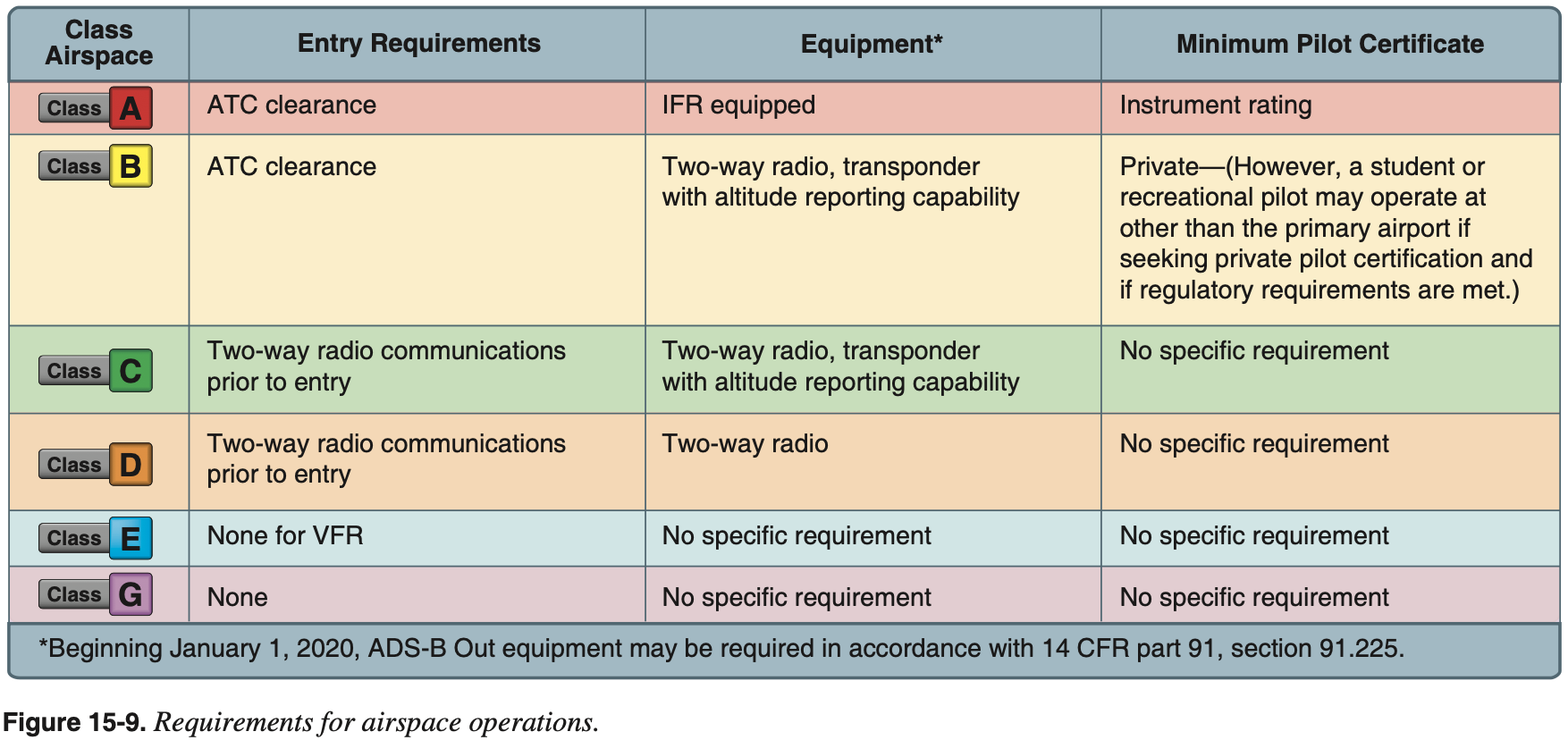
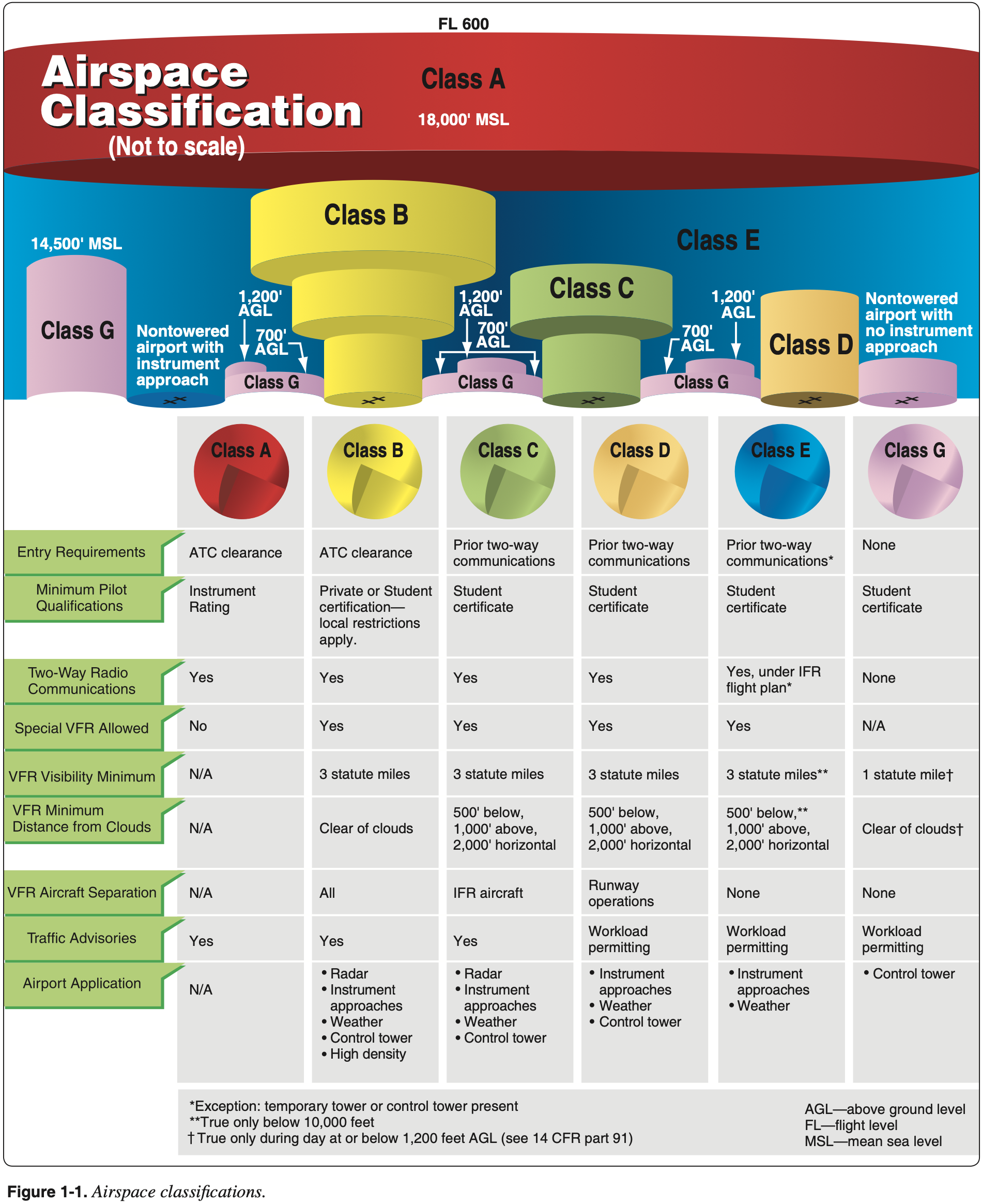
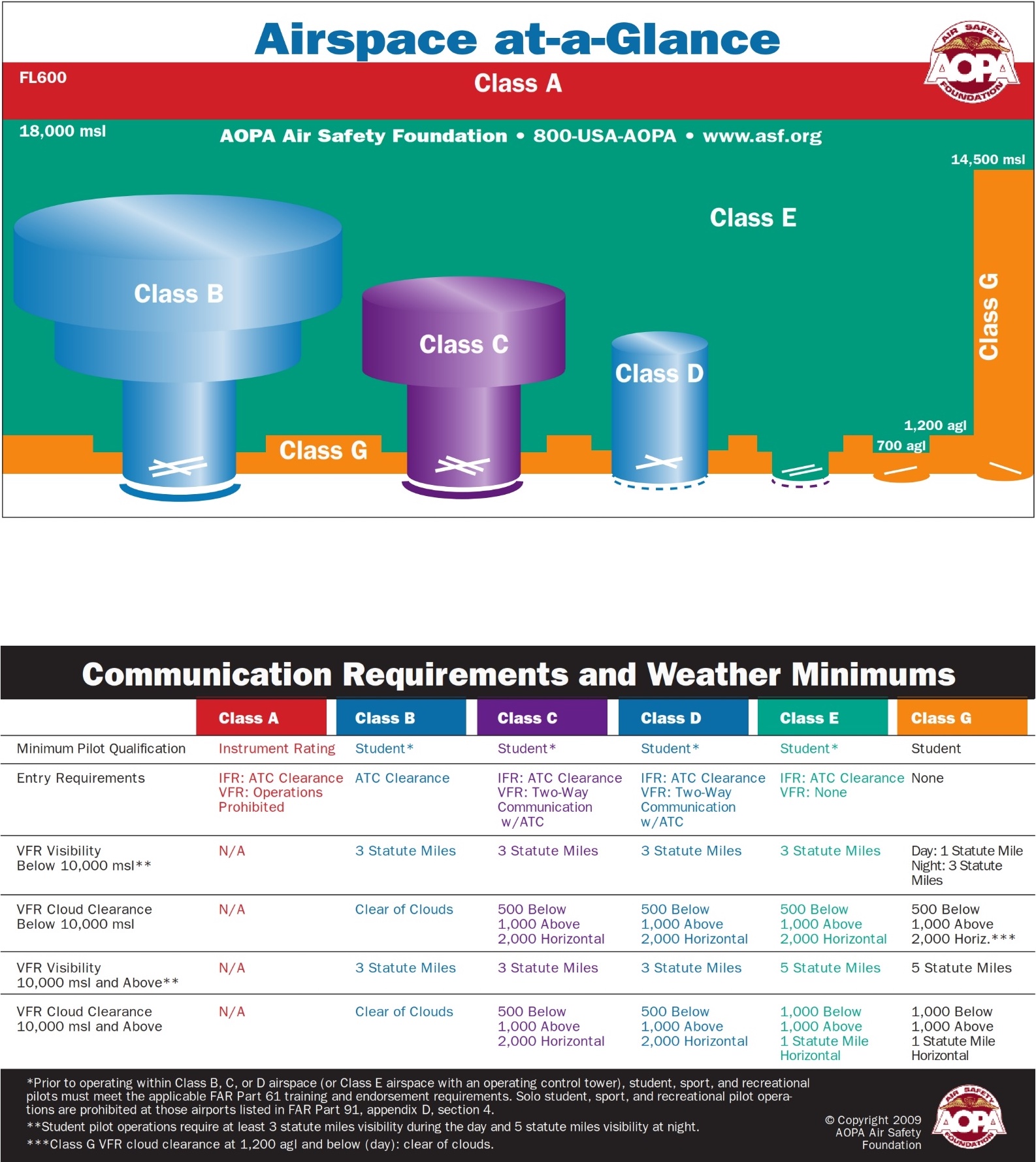
Controlled Airspace
Class A
- AIM 3-2-2
- Above 18,000 feet, FL is used
- FL180 – FL60
- Active across entire NAS + 12 nm off the coast
- Requirements: IFR Flight Plan
- DME over FL240
Class B
- AIM 3-2-3
- SFC to 10,000 MSL
- B = Busy
- Upside down wedding cake
- Must be cleared to enter
- Solid blue line on VFR chart
- VFR coordidors sometimes exist as small paths through B airspace
Class C
- AIM 3-2-4
- Less busy than B, but still high volume of large aircraft
- SFC to 4,000 MSL
- 5 nm core, 10 nm radius, where outer shelf starts at 1,200 ft
- Two-way radio communication to enter (note tail number)
- Solid magenta line on VFR chart
- Spacing / separation: 7110.65 Section 8. Class C Service- Terminal 7-8-3
Class D
- AIM 3-2-5
- Operating control tower
- SFC – 2,500 ft
- 5 sm / 4.4 nm Radius
- Two-way radio communication to enter
- Dashed blue line on VFR chart
- When a D airspace tower closes, the airspace becomes E to surface, unless weather/communication is not available at the surface, then it is E only down to 700.
- 14 CFR §91.129 - Operations in Class D airspace
Class E
- AIM 3-2-6
- Any controlled airspace that is not A-D
- Class E airspace below 14,500 feet MSL is charted on Sectional, Terminal, and IFR Enroute Low Altitude charts.
- So technically the default is G up to 14,500 unless otherwise charted
- However, with very few exceptions (see class G airspace below) class E is charted to start at either 700' or 1200' AGL
- So basically the default is that E starts at 1200' AGL except where charted to start at 700' AGL, or where shown to not to start at 1200' AGL.
- This can be seen along the US border, where it shows the start of E at 1,200'
- 700/1200 ft AGL – 18,000 ft MSL (A), up to 12 nm off US coast
- "1200 ft, except where the elephant steps"
- VFR chart Colors
- To surface: dashed magenta
- 700 ft floor: ombre magenta
- 1200 ft floor: ombre blue
- Note: ombre is a French word meaning shaded, where one hue blends to another
- Weather, Aircraft, Pilot Requirements
Uncontrolled Airspace
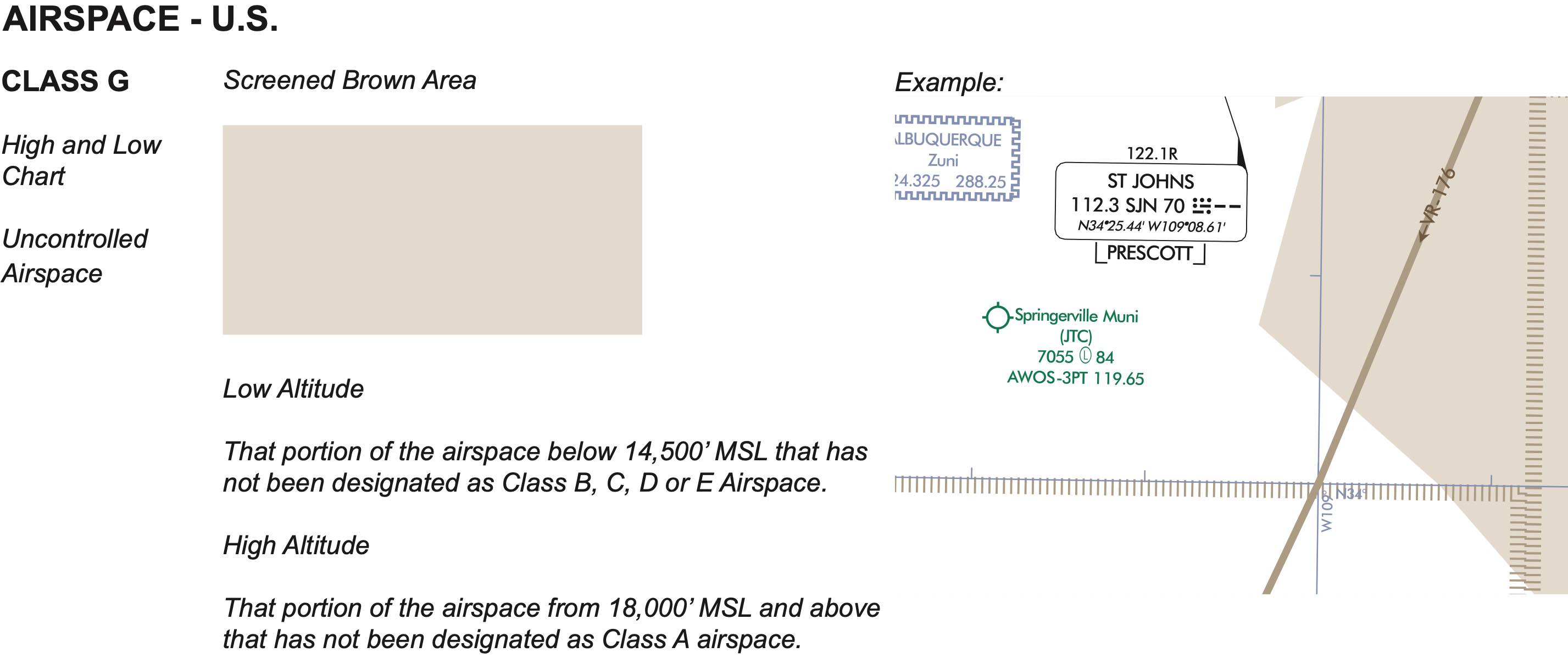
Class G
- AIM 3-3
- SFC – Base of class E
- Even though there is no ATC, still minimum requirements to comply with FAA
- In certain designated areas class G extends up to 14,500 feet
- This is on VFR charts, but easier to see on IFR charts
Special Use Airspace (SUA)
Prohibited Area
- Think "Pentagon"
- Established for security reasons
- Flight is not permitted
- Unless permission from the "using agency" is given 14 CFR §73.83
- E.g. Camp David, White House
- Blue on VFR chart
- AIM 3-4-2
Restricted Area
- Think "Rockets"
- Seperates civilian traffic from potentially hazardous military activities
- Requires permission from ATC ("the controlling agency") to fly through (when active)
- Who is the controlling agency?
- When flying IFR, don't really need to worry about it. ATC will either allow you to operate in the restricted area without an explicit clearance, our route you around it. See AIM 3-4-3(b).
- ATC can confirm if hot & can provide crossing
- Blue on VFR chart
- AIM 3-4-3
Warning Area
- Think "Water Rockets"
- Purpose is to warn aircraft of potential dangers
- Similar to Restricted, but over water
- Blue on VFR chart
- Extends out from 3 miles off coast
- Potentially hazardous activities
- VFR flight is permitted but not recommended
- No clearance Required
- No separation between civilian and military aircraft
- AIM 3-4-4
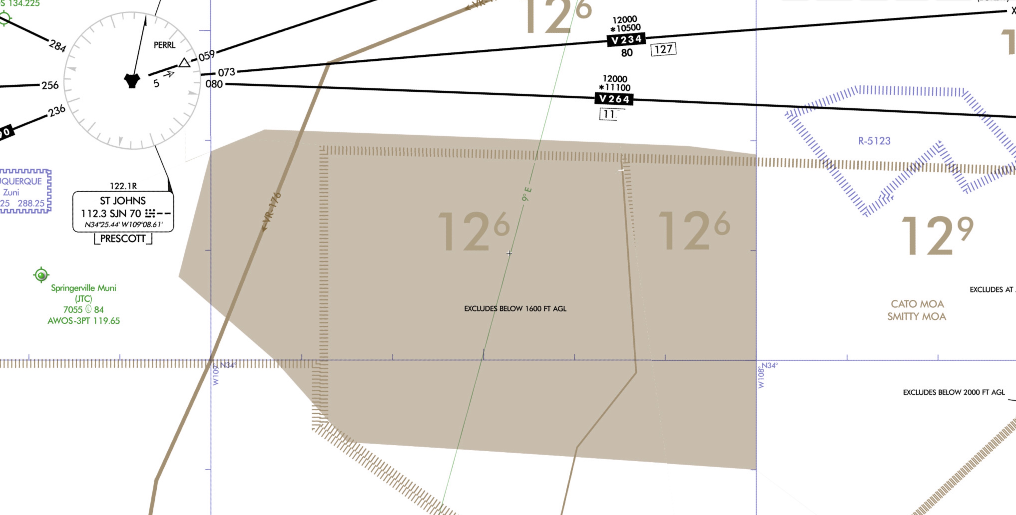
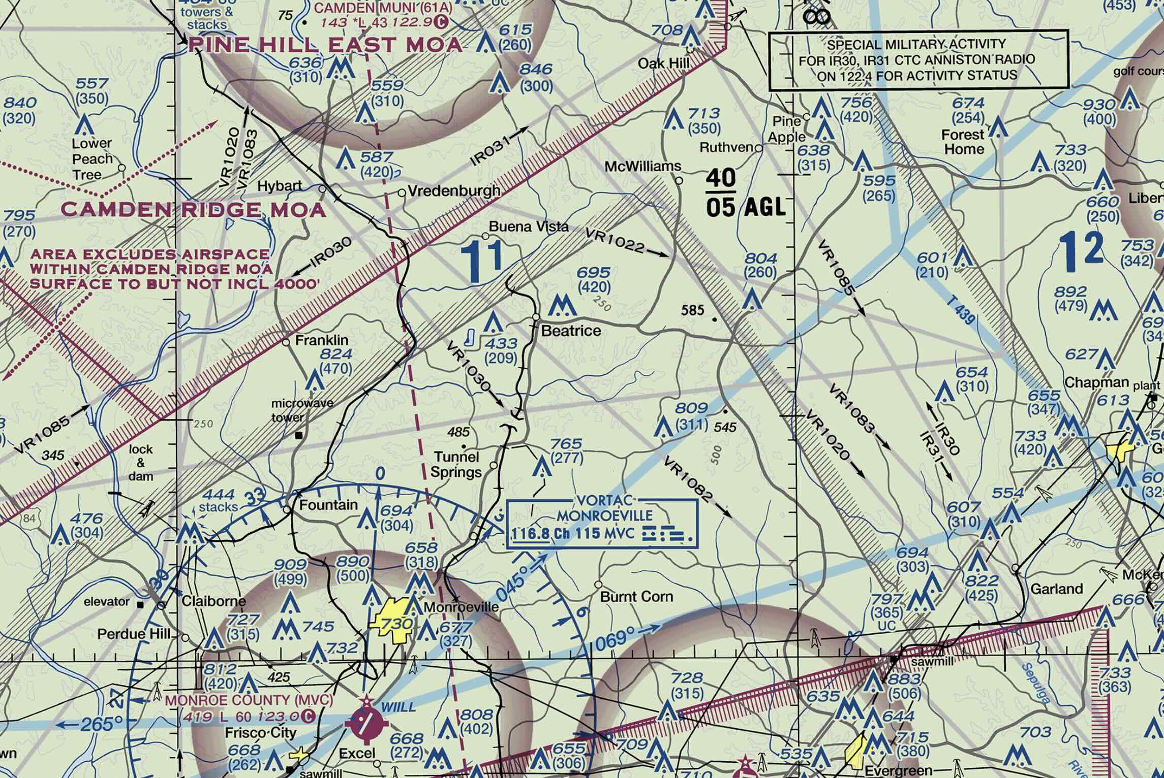
Military Operation Area (MOA)
- Separate IFR aircraft from military ops
- Allowed through, just exercise extreme caution
- Magenta on VFR chart
- AIM 3-4-5
Alert Area
- Think "A lot of traffic"
- Depicted with "A" followed by ID number
- May contain a high volume of traffic, not suitable for training
- Magenta on VFR chart
- High volume of unusual aerial activity or pilot training
- Can fly through alert Area
- Keep lookout for traffic
- AIM 3-4-6
Controlled Firing Areas (CFA)
- Noted in the Aeronautical Chart User's guide as SUA
- Not charted, do not cause aircraft to change path
- If aircraft is spotted, firing must stop
- AIM 3-4-7
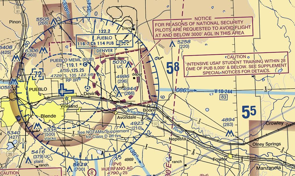
National Security Area (NSA)
- Areas of increased safety/security for ground facilities (e.g. Pueblo Supply Depot)
- Generally requested not to fly through / voluntarily avoid
- Sometimes flight is prohibited via TFR/NOTAM
- AIM 3-4-8
Other Airspace
Airport Advisory/Information Services
- Local Airport Advisory (LAA)
- Provide service when tower is closed
- Available only in Alaska
- Remote Airport Information Service (RAIS)
- AIM 3-5-1
Military Training Route (MTR)
- Developed by Department of Defense and FAA
- Established below 10,000 feet MSL for flying at speeds in excess of 250 kts
- 3 or 4 digits starting with
VRorIRon chartIRroutes are flown under IFRVRroutes are flown under VFR- 4 digit number means it has no segmenent above 1,500 AGL
- 3 digit number means it has one or more segment above 1,500 AGL
- AIM 3-5-2
- Nonparticipating aircraft are not prohibited from flying within an MTR, but extreme vigilance should be exercised
Temporary Flight Restrictions (TFR)
- FDC NOTAM issued
- Name, effective time, location
- Examples: VIP, disaster relief, space agency ops
- Established to...
- Protect persons and property in the air or on the surface from an existing or imminent hazard
- Provide a safe environment for disaster relief aircraft operation
- Prevent an unsafe congestion of sightseeing aircraft above an incident/event which may generate a high degree of public interest
- Protect declared national disasters for humanitarian reasons in Hawaii
- Protect the President, VP, or other public figures
- Provide a safe environment for space agency operations
- FDC NOTAM issued to designate TFR. Begins with phrase "FLIGHT RESTRICTION" followed by location, effective time period, area defined in sm, and altitudes affected for temporary restriction.
- Includes FAA coordination facility and telephone number, reason for restriction, and other appropriate information.
- AIM 3-5-3
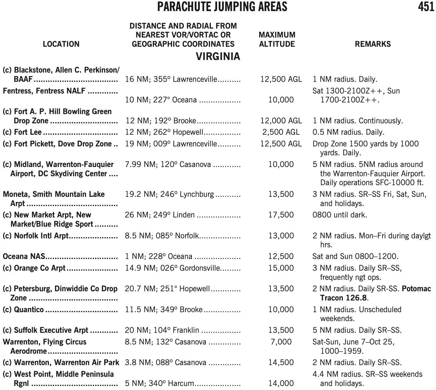
Parachute Jumping Areas
- Published in A/FD
- AIM 3-5-4
Published VFR Routes
- Used for transitioning through complex Class B
- Example: NY VFR Corridor
- AIM 3-5-5
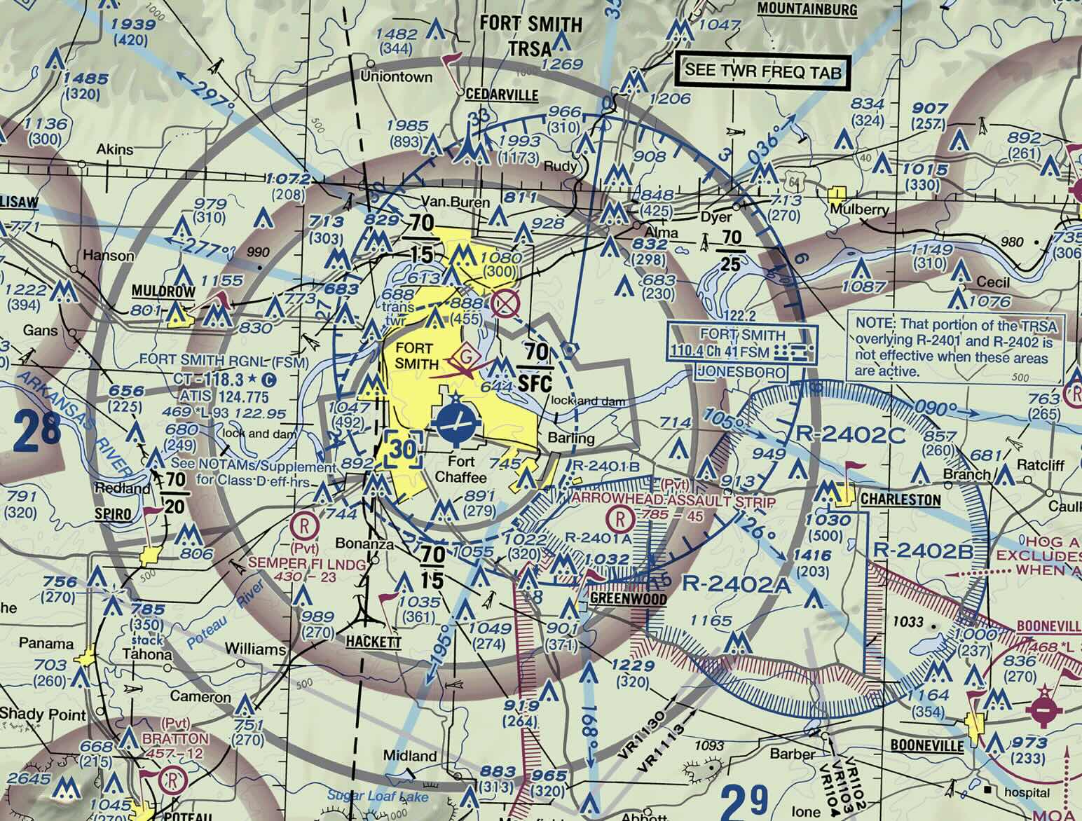
Terminal Radar Service Area (TRSA)
- Areas where participating pilots can receive additional radar services
- Provide separation between all IFR operations and participating VFR traffic
- Voluntary but encouraged participation
- Primary airport(s) within TRSA is Class D airspace
- Provide additoinal radar services to participating aircraft
- Optional, but encouraged to participate
- Chart depiction: solid black line, altitudes for each segment.
- Depicted on VFR sectional charts and terminal area charts.
- Class D portion depicted with blue segmented line.
- AIM 3-5-6
Special Air Traffic Rules (SATR) and Special Flight Rules Area (SFRA)
- AIM 3-5-7
- Special air traffic rules for aircraft operating within the boundaries of certain designated airspace.
- 14 CFR §93
- Examples
- Grand Canyon
- Niagra Falls
Washington, DC, Special Flight Rules Area (SFRA) including the Flight Restricted Zone (FRZ)
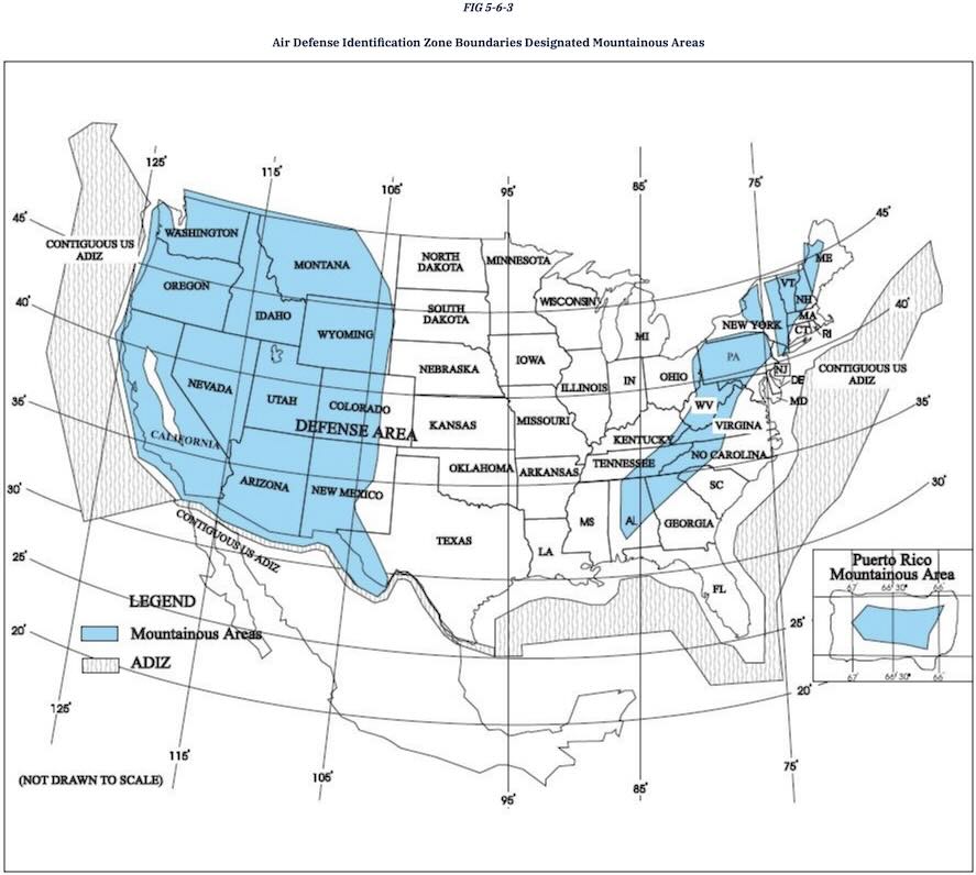
Air Defense Identification Zones (ADIZ)
- Exists along coast
- Requires identification of aircraft in the interest of national security
- All aircraft entering must be on an IFR or Defense Visual Flight Rules (DVFR) flight plan
- Two-Way Communication
- Squawk discrete code
- If DVFR must file estimated crossing time, update if it changes more than 5 minutes
- There is no ADIZ between the U.S. and Canada.
- AIM 5-6-4
- 14 CFR 99.3
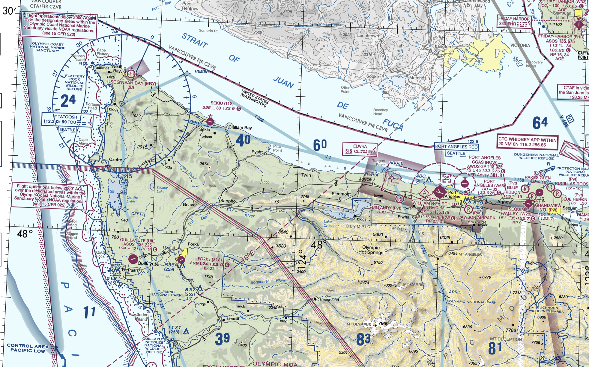
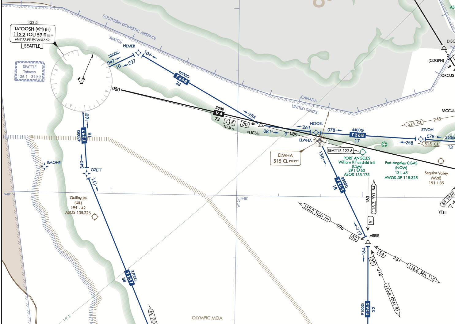
Victor Airways
- Victor airways - from 1200 AGL up to but not including FL 180
- Airways are 4 miles each side of centerline
Additional Airspace
- Defense Area
- All U.S. airspace that is not part of the ADIZ
- Mode C Required Airspace
- Mode C veil
- From the surface to 10,000' MSL within a 30 NM radius of the primary airport(s) for which a Class B is designated
- Depicted by a solid magenta line.
- Wildlife & Recreational Areas
- Provide protection for wildlife
- Special conservation area - 2000 ft min AGL
- Grand canyon special flight rules
- ATC and the NAS (Includes Weather Minimums, Operation Minimums, and Special VFR)
- Purpose: Prevent collisions, expedite the flow of traffic
- Ensure coordination between handoffs
Airspace Requirements
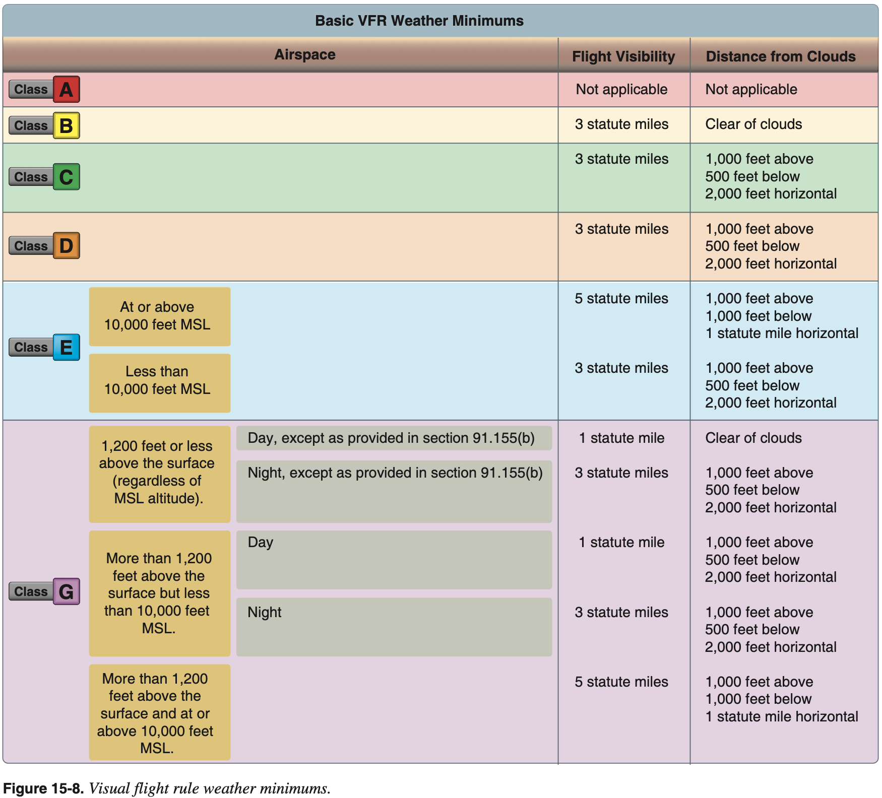
VFR Weather Minimums
- 14 CFR §91.155 - Basic VFR weather minimums
The exception noted in the figure below in G airspace within 1200 AGL:
Airplane, powered parachute, or weight-shift-control aircraft. If the visibility is less than 3 statute miles but not less than 1 statute mile during night hours and you are operating in an airport traffic pattern within 1⁄2 mile of the runway, you may operate an airplane, powered parachute, or weight-shift-control aircraft clear of clouds.
Two-Way Radio Communication
Two-way radio communication requirement is met when ATC uses your aircraft ID (tail number or callsign).
For example, if ATC says "aircraft calling standby" this does not constitute two-way communication.
If ATC says "N12345 standby" that does.
- See the note in AIM 3-2-5(b)
If the controller responds to a radio call with, “[aircraft callsign] standby,” radio communications have been established and the pilot can enter the Class D airspace.
- See also JO 7110.65BB 7-8-4
- See the note in AIM 3-2-5(b)
14 CFR §91.129(c)(1) says:
Each person must establish two-way radio communications with the ATC facility (including foreign ATC in the case of foreign airspace designated in the United States) providing air traffic services prior to entering that airspace and thereafter maintain those communications while within that airspace.
Communication with TRACON or Center on flight following does not satisfy the requirement to fly through Class D, as neither of these is the Class D tower, which is the facility controlling that airspace.
However JO 7110.65AA 2−1−16(b) says:
Coordinate with the appropriate control tower for transit authorization when you are providing radar traffic advisory service to an aircraft that will enter another facility's airspace.
NOTE - The pilot is not expected to obtain his/her own authorization through each area when in contact with a radar facility.
AIM 3-2-1(d) says:
VFR Requirements. It is the responsibility of the pilot to ensure that ATC clearance or radio communication requirements are met prior to entry into Class B, Class C, or Class D airspace. The pilot retains this responsibility when receiving ATC radar advisories. (See 14 CFR Part 91.)
Therefore, there is some ambiguity about whose responsibility it is
This was clarified in the Air Traffic Procedures Bulletin October 2017
This bulletin provides guidance to controllers as to how they can help coordinate
The Granby 2006 Legal Interpretation additionally states that, with respect to C airspace, TRACON is the controlling agency
- Note: can find a list of FAA Legal interpretation letters at the FAA Regulations Division Legal Interpretations & Chief Counsel's Opinions page
Ultimately, it is the pilot's job to check when on flight following whether a switchover to tower is required before flying through C or D airspace, or whether ATC has already coordinated.
Transponder
- A transponder is a radar beacon transmitter/receiver installed in the instrument panel.
- ATC beacon transmitters send out interrogation signals continuously as the radar antenna rotates.
- When an interrogation is received by a transponder, a coded reply is sent to the ground station where it is displayed on the controller's scope.
- A reply light on the transponder panel flickers every time it receives and replies to a radar interrogation. Transponder codes are assigned by ATC.
- Transponders used in general aviation are mode A
- If it can do altitude encoding it has mode C capability
- Mode C sends pressure altitude to ATC
- Adjusting the altimeter's Kollsman window has no effect on the altitude read by the controller.
- A transponder code consists of four numbers from 0 to 7 (4,096 possible codes)
- Mode S transponder sends/receives some extra data
- Mode S offers improvements over Mode C
- 24-bit addresses instead of 4-bit
- Transmits more data
- Aircraft Collision Avoidance System (ACAS)
- Heading, roll angle, etc.
Requirements
- Must have transponder with mode C in
- Class A, B, and C airspace
- Above 10,000 MSL, except when 2,500 AGL.
- Within 30 nm of class B primary airports (in and above the mode-C veil)
- Within 10 nm of certain designated airports, excluding airspace which is both outside the Class D surface area and below 1,200' AGL
- Flying into, within, or across the ADIZ
Comparison Against ADS-B Requirements
- Mode-C is required in the same places as ADS-B except it is all airspace at or above 10,000 feet MSL, excluding airspace at and below 2,500 feet AGL (not just class E).
- Mode-C is not required in the Gulf of Mexico area specified for ADS-B.
- Mode-C is required into/within/across the ADIZ
ADS-B
ADS-B
A surveillance technology in which an aircraft determines its position via satellite navigation or other sensors and periodically broadcasts it, enabling it to be tracked.
- ADS-B uses plane's WAAS GPS and broadcasts information to other planes and ground stations.
- Ground stations compile and rebroadcast received information.
- This is known as ADS-B Out.
- ADS-B In is the capability for other planes to receive this information as traffic, as well as weather information.
- Acronym
- Automatic - no pilot input required
- Dependendent - requires positon input, e.g. WAAS GPS
- Surveilance - provides aircrafts location, direction, and climb/descent indication
- Broadcast - broadcasts the surveilance information to be seen by others
- Components of ADS-B In
- Traffic Information Services-Broadcast (TIS-B)
- Provides traffic information to planes with ADS-B receivers.
- The traffic includes that which is not broadcasting its own output via ADS-B, because it's able to use radar data and conventional transponder data to understand where aircraft are.
- Flight Information Services-Broadcast (FIS-B)
- Provides NEXRAD graphical weather in (for example in G1000).
- Also provides info on SUA and TFRs.
- Traffic Information Services-Broadcast (TIS-B)
- FAA Automatic Dependent Surveillance-Broadcast (ADS-B)
- FAA Equip ADS-B
- 978 and 1090 MHz
FIS-B
Requirements
- ADS-B is required in:
- Class A, B, and C airspace.
- Class E airspace at or above 10,000 feet MSL.
- Excluding airspace at and below 2,500 feet AGL.
- Within 30 nautical miles of a Class B primary airport (the Mode C veil).
- Above the ceiling and within the lateral boundaries of Class B or Class C airspace up to 10,000 feet.
- Class E airspace over the Gulf of Mexico, at and above 3,000 feet MSL, within 12 nm of the U.S. coast.
- 14 CFR §91.225 - Automatic Dependent Surveillance-Broadcast (ADS-B) Out equipment and use
- 14 CFR §91.227 - Automatic Dependent Surveillance-Broadcast (ADS-B) Out equipment performance requirements
Airspace Speed Limits
- Defined in 14 CFR §91.117 - Aircraft speed.
- Below 10,000' MSL: 250 KIAS.
- For C and D airspace, within 4 nm and within 2,500 AGL of the primary airport: 200 KIAS.
- Under or through (VFR cooridor) B airspace: 200 KIAS.
- These limits can be exceeded if safety requires it.
- Speed limits are in indicated airspeed.
- In addition 14 CFR §91.817 - Civil aircraft sonic boom prohibits the operation of a civil aircraft in the United States at a true flight Mach number greater than 1.
Overlapping Airspace
As an example, see some airspace around
KBFIandKSEA-- there is D airspace that extends upwards into B.See 14 CFR §71.9 - Overlapping airspace designations:
When overlapping airspace designations apply to the same airspace, the operating rules associated with the more restrictive airspace designation apply.
See also AIM 3-1-3 which also clarifies what is meant by the relative level of "restrictiveness" of the airspace classes.
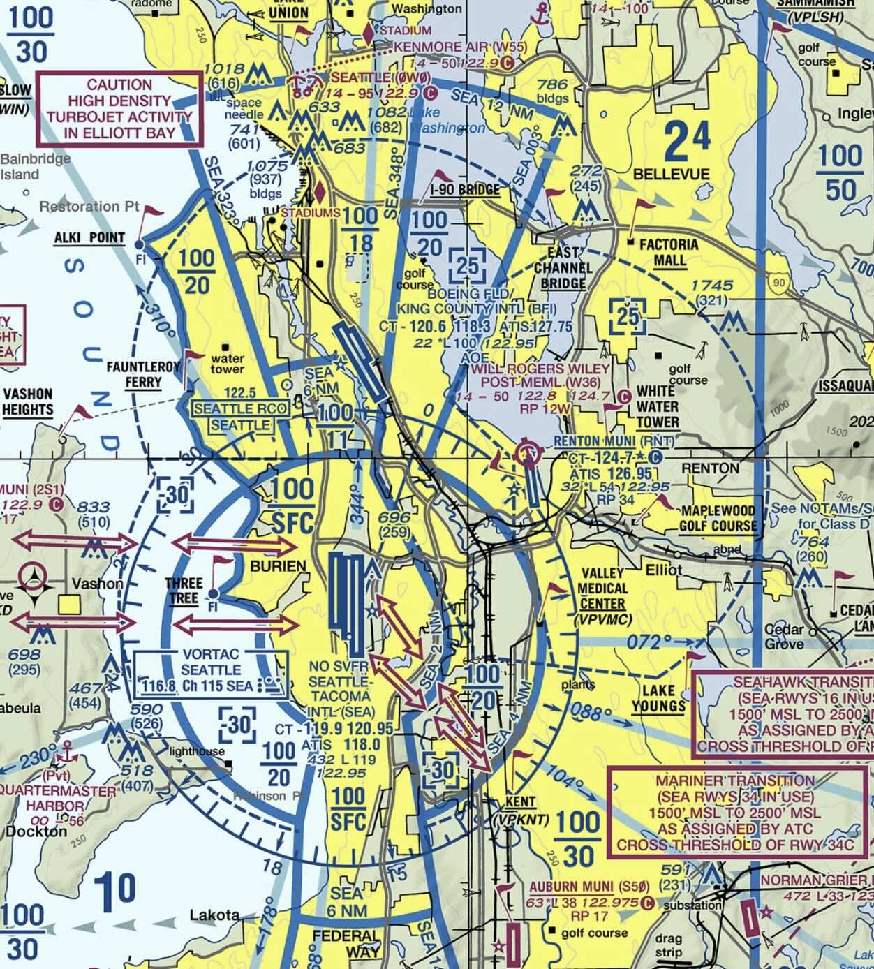
KBFI extending upwards into KSEA B airspace.Chart Symbols
- TBD
Currency of Publications
- TBD
Special VFR Requirements
- Provides IFR separation even though not doing IFR operation
- Must be requested by pilot and approved by ATC
- Need 1 SM visibility and clear of clouds
- If at night, pilot and plane need to be instrument rated
- Can do in controlled airspace up to 10,000 MSL (something about airspace to ground?)
- If ground visibility not reported, just need 1 SM flight visibility
- Some airports do not permit special VFR
- Q: Is there any real reason to ever do special VFR? It seems dumb.
- 14 CFR §91.157 - Special VFR weather minimums
- During the day, SVFR requires
- ATC clearance
- 1 SM visibility
- Clear of clouds
- At night, the pilot must be instrument rated and the aircraft must be IFR equipped.
- During the day, SVFR requires