Navigation and Cross-Country Planning
This page covers Task D. Cross-Country Flight Planning from the FAA-S-ACS-6C Private Pilot Airman Certification Standards.
Terms
Navigation
- Latitude
- Horizontal lines that run around the globe where the north-south distance is constant
- Longitude
- Vertical lines that specify east-west coordinate
- Together longitude and latitude give coordinates on the globe
- Specified in degrees, where each degree is further divided into 60 minutes, and each minute into 60 seconds, where seconds can be decimals
- Time zones
- Use of GMT / UTC or "Zulu" time
- True vs Magnetic coordinates
- Heading
- Direction the airplane is pointed
- Course
- Planned direction of flight
- Track
- Actual direction plane is flying
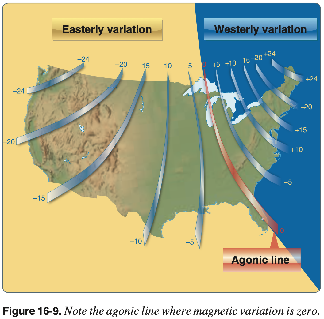
- Magnetic Variation
- Also called magnetic declination
- Angle between true north and magnetic north
- Easterly vs. Westerly variation
- Variation can be thought of as where you would end up if you tried to follow your compass to true north
- For example, in the northeastern United States where the variation is westerly, if you followed your compass north you would end up west of true north.
- I find this easier than the memory aid "west is best, east is least" as it doesn't help remember if it applies when converting from or to magnetic direction
- This is encountered mostly in flight planning, where courses are initially defined by and most readily read from charts as a true course
- These then need to be converted to magnetic course to be able to fly with a compass
- Isogonic line
- Magnetic variation is constant
- Agonic line
- No magnetic variation - compass points to true north
- Magnetic Deviation
- Compass error caused by local magnetic field around airplane
- Dependent on which direction the aircraft is facing
- Bearing
- Angle between two lines, such as between aircraft's track and VOR radial
- Map projections
- How to display a "round" globe on a flat piece of paper
- Azimuthal Projection – sphere onto a plane (Earth)
- Conic Projection – map fitted to a cone
- Cylindrical Projection – projects entire world map at once
- When measuring true course on a line drawn on a sectional chart, measure the course angle at the midpoint of the line
- Standard Sea Level Pressure
- 29.92" Hg
- Standard Sea Level Temperature
- 15 °C
Altitudes
- Indicated altitude
- What altimeter says
- True altitude
- Actual MSL height
- Absolute altitude
- AGL height
- Given by subtracting height of terrain from true altitude
- Pressure altitude
- Height above 29.92 inHg standard datum plane (SDP).
- The standard datum plane is the theoretical level in the atmosphere where the pressure is 29.92 inHg.
- What altimeter reads when setting altimeter to 29.92 inHg.
- Density altitude
- Pressure altitude corrected for nonstandard temperature
- Vertical distance above sea level in the standard atmosphere at which a given density is to be found.
Converting
- If the temperature is colder than that of the standard atmosphere, true altitude will be lower than indicated altitude
- First determine the standard temperature at the indicated altitude
- Recall: 15 °C at sea level and lapse rate of 2 °C per 1000 ft
- Example: at 20,000 ft the standard temperature is -25 °C, if the actual temperature is -35 °C then the ISA deviation is -10 °C.
- Note: in the formulas below, temperature is in Celcius.
- True Altitude = Indicated Altitude + ((OAT - ISA Temperature) x Indicated Altitude / 273 )
- Pressure Altitude = ((29.92 - Current Altimeter Setting) x 1,000) + True Altitude
- Density Altitude = Pressure Altitude + (120 x (OAT - ISA Temperature))
Airspeed
- Indicated Airspeed (IAS)
- What the airspeed indicator says
- Calibrated Airspeed (CAS)
- Indicated airspeed corrected for instrument and position error
- These errors are due to pressure around the aircraft the static port, for example, does not measure free-stream static pressure perfectly, especially not across the whole range of flight conditions, flap settings, or a large angle of attack causing the free stream flow not to directly enter the pitot tube.
- Calibrated airspeed is what the plane "sees"
- When flying at sea level under International Standard Atmosphere (ISA) conditions (15 degrees Celsius, 29.92 inHg, 0% humidity), calibrated airspeed is the same as true airspeed
- Equivalent Airspeed (EAS)
- Calibrated airspeed corrected for compressibility effects
- True Airspeed (TAS)
- Calibrated airspeed corrected for altitude and nonstandard temperature
- For example, as altitude increases (and density decreases) the calibrated airspeed will tend to decrease (less dynamic pressure as measured by the pitot tube) even while true airspeed remains the same.
Plotting Course, Stops, Alternates, Unforseen Circumstances
- Time, distance, fuel calculations
- Make sure to plan route to avoid terrain and certain airspace
- 14 CFR §91.151 Fuel requirements for flight in VFR conditions
- Personal minimum should be higher than these
- Consider winds, visibility, communications, radar service (flight following) when planning altitude
- Terrain, navaids
- Services available at stops
- VFR cruising altitudes
- Required to be maintained when flying more than 3,000 feet AGL (and less than 18,000 MSL) based on magnetic course.
- See 14 CFR §91.159
- Use acronym ONE - Odd North / East
- East: odd feet + 500 (e.g. 3,500, 5,500)
- West: even feet + 500 (e.g. 4,500, 6,500)
- No person may operate any portable electronic device on any aircraft while it is operated under IFR.
- Unforseen events
- Availability of alternates along route
- Impact of terrain if emergency landing is required
Pilotage and Dead Reckoning
Pilotage
- Navigation by reference to landmarks or checkpoints
- For example, following a highway
- Becomes difficult in low visibility or in areas that lack prominent features
- Use prominent checkpoints that can be seen
- Consider checkpoints as boundaries
Dead reckoning
- Navigation solely by means of computations based on time, airspeed, distance, and direction.
- For example, calculating wind correction and speed, and figuring out what approximately southerly heading would be required to fly from
KHEFtoKRIC.
Using Pilotage and Dead Reckoning
- Pilotage and dead reckoning are distinct skills but are applied together to successfully navigate
- Upon reaching a particular point along the route, dead reckoning is used to set the initial heading
- Pilotage is used to adjust the heading as needed to arrive at the next desired waypoint
- For example,
KEDUtoKCIC(buttes and grain elevator)
- For example,
Fundamentals of Radio Navigation
- Predetermined path followed using radio waves
- Tune appropriate navigation facility and control ground track based on the instrument's indication
- Can use ground stations or space satellites that transmit signals to navigation radio receivers in the airplane
- VOR
- NDB
- LORAN-C
- GPS
Diversion to Alternate
- Might be required due to
- Weather
- Illness
- Aircraft problems
- Determine where you are
- Assess limitations (PAVE) and how soon you need to land
- Find nearest practical airport
- Charts
- GPS (NRST function)
- ATC
- Turn in direction of airport
- Note time
- Use groundspeed to determine ETE and fuel requirements
- Assess the consequences (Will I make it, are there services available)
- Always use a safe margin
- Leverage ATC & FSS (122.2) – "Radio" & Location
- Use shortcuts and rules of thumb in calculations
Lost Procedures
- Use the 5 C's checklist
- Circle: Stay in one spot
- Climb: Better visibility, better signal and communication strength
- Communicate: Ask for vectors to a known location
- Confess: Admit you are lost
- Calculate: Figure out fuel remaining, where to go, groundspeed, distance covered
- Double check maps and look for landmarks
- Use secondary navigation systems (GPS, VOR)
- Nearest or Direct-To
- 2x VORs to identify location
- Use ATC (report who you are last known location, heading, airspeed, altitude)
- Check town water towers or airfield names
- Compare the heading indicator to the magnetic compass, and note the direction of error before resetting
- Can help determine if you are left or right of course
Fuel Consumption Calculation
- Distance - measure length of course
- Time - divide distance by groundspeed
- Correct TAS for wind
- Total fuel consumption - multiply projected hourly fuel burn by time
- Repeat calculation for every segment of the flight where the groundspeed changes
Importance of Flight Log
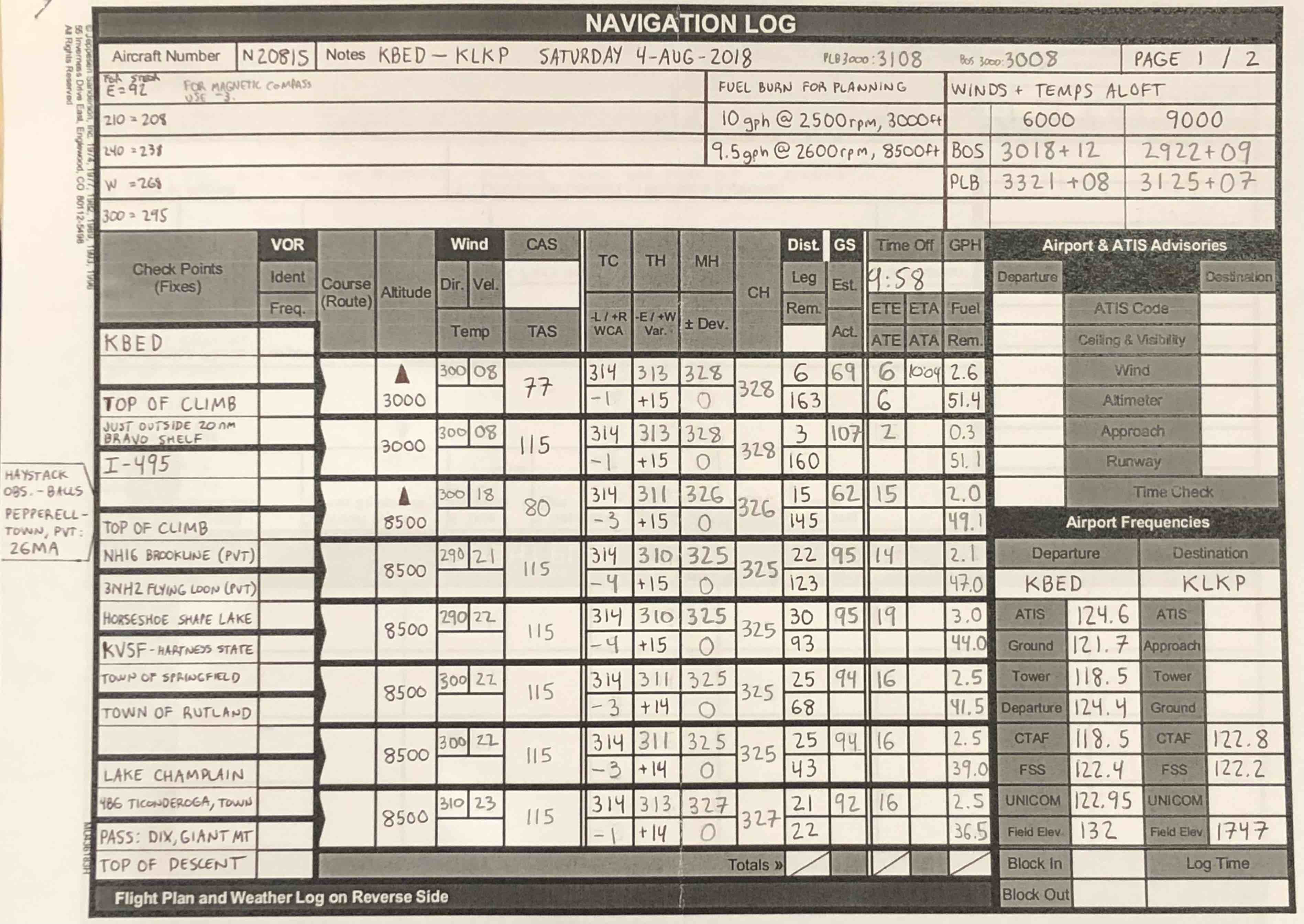
- Track position and progress along flight
- Compare plans against reality
- Are we on the right track
- Are we using as much fuel as expected
- Helps keep information organized, in order, and available
- Frequencies
Weather Check and Go/No-go
- Obtain weather briefing-shows where problems may occur during the flight
- Pilot must be familiar with weather for the flight
- Use good judgment in deciding if to take the flight
- Consider weather factors in relation to the equipment to see if the plane can handle the flight
- Personal minimums
- Should be a no-go decision if
- Thunderstorms, especially embedded
- Fast-moving fronts/squall lines
- Moderate turbulence
- Icing
- Fog, visual obscurations
- Pilot mental and physical condition a factor (IMSAFE)
- Recent flight experience is important in making the decision
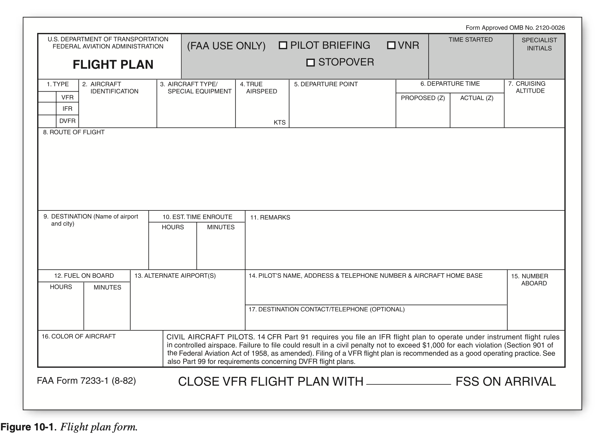
Filing a Flight Plan
- Flight Service Station (FSS)
- Calling 1-800-WX-BRIEF
- 1800wxbrief.com
- Provided by Leidos Flight Service
- The FAA-contracted Flight Service provider/resource
- During flight
- To find Automated Flight Service Station (AFSS) frequency, can use Foreflight (it's listed for each airport) otherwise, look for the frequency over VOR boxes.
- Common frequency is 122.2
- Foreflight
- Flight plan uses true airspeed when filing
- VFR flight plans are held for 2 hour after proposed departure time and 30 minutes before
- Have 30 minutes to close VFR flight plan after ETA
- If your flight plan is not closed search and rescue services will come looking
- Tower does not close VFR flight plans
References
- FAA-H-8083-25B Pilot's Handbook of Aeronautical Knowledge
- FAA-H-8083-15B Instrument Flying Handbook
- Chapter 9: Navigation Systems
- Aeronautical Information Manual
- FAA-AC-20-138D Airworthiness Approval of Positioning and Navigation Systems
- FAA-AC-90-105A Approval Guidance for RNP Operations and Barometric Vertical Navigation in the U.S. National Airspace System and in Oceanic and Remote Continental Airspace
- FAA-AC-90-108 Use of Suitable Area Navigation (RNAV) Systems on Conventional Routes and Procedures
- FAA-AC-90-100A U.S Terminal and En Route Area Navigation (RNAV) Operations
- RAIM Service Availability Prediction Tool (SAPT) Summary Page
- FAA-H-8083-3C Airplane Flying Handbook
- Private Pilot - Airplane Airman Certification Standards (FAA-S-ACS-6B)
- FAA Aeronautical Chart Users' Guide
- VFR Raster Charts
- Aeronautical Charts
- Foreflight
- AOPA Chart Symbols PDF